What is a Watershed? |
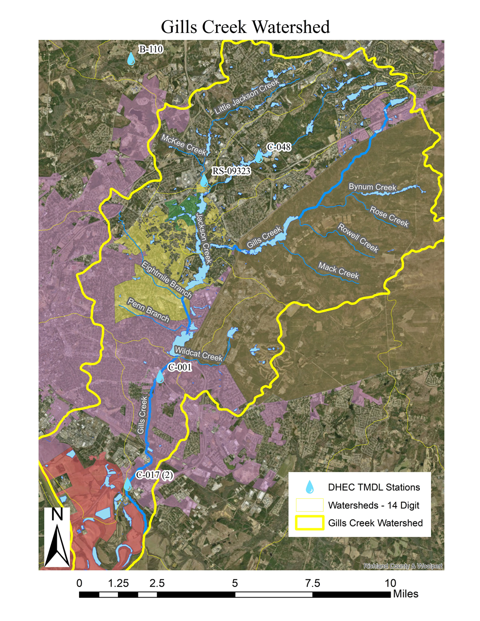
We restore, educate and advocate for the Gills Creek Watershed. What is a watershed? A watershed is a "precipitation collector" --an area of land that drains all the rainfall and small streams into a common outlet such as the point where a river joins a bay, or a creek joins a river. Watersheds can be small, like the Gills Creek Watershed, or huge--think of the area of our country that ultimately drains into the Gulf of Mexico through the Mississippi River. No matter where you live, you're in a watershed. The City of Columbia tracks information about the Broad, Congaree, Lower Saluda and Gills Creek--all major watersheds within City limits. For details about Gills Creek, click here.
Facts about the Gills Creek Watershed:

Not into reading? You can learn all about what we do by tuning in to this episode of Around Town, with Columbia Mayor, Daniel Rickenmann and GCWA Executive Director, Bailey Slice Parker. Revitalizing Gills Creek: How the Watershed Association is Protecting Columbia’s Most Impacted Waterway with Bailey Parker
In this episode of the Around Town podcast, Mayor Daniel Rickenmann sits down with Bailey Parker, the executive director of the Gills Creek Watershed Association. Bailey shares her unexpected journey from a career in music to leading one of Columbia’s most crucial environmental organizations. They discuss the ongoing efforts to restore Gills Creek, the challenges posed by urban development, and the importance of community involvement in conservation. Tune in to learn how Bailey and her team are working to protect Columbia’s waterways and how you can get involved in preserving these vital natural resources. |