MAPPING RESOURCES
 Richland County GIS Maps
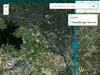
To help respond to the declared Natural Disaster in Richland County, the county GIS team has worked with numerous partners to provide recovery and assessment support. As part of that effort, several geospatial tools have been developed and are available for use by local authorities for coordination efforts and to the public for information including a Road and Dam Status Viewer, a Flood Inundation Tool, and a Flood Data Viewer. Thanks to Woolpert Inc. and Google for their support.
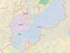 GCWA Watershed Muncipal Map showing the watershed boundary and boundaries, roads, lakes and streams within the watershed. Produced in 2012 by Fuss & O'Neill for the Gills Creek Watershed Association and the Richland County Conservation Commission. Click image to expand map.
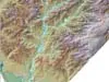 Gills Creek Watershed Relief Map showing the watershed boundary and elevations within the watershed. Produced in 2012 by Fuss & O'Neill for the Gills Creek Watershed Association and the Richland County Conservation Commission. Click image to expand map.
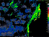 SC Department of Natural Resources interactive journal of the 2015 rain event and subsequent flooding presented through data and maps showing the conditions which contributed to the disaster. Click here to expand map.
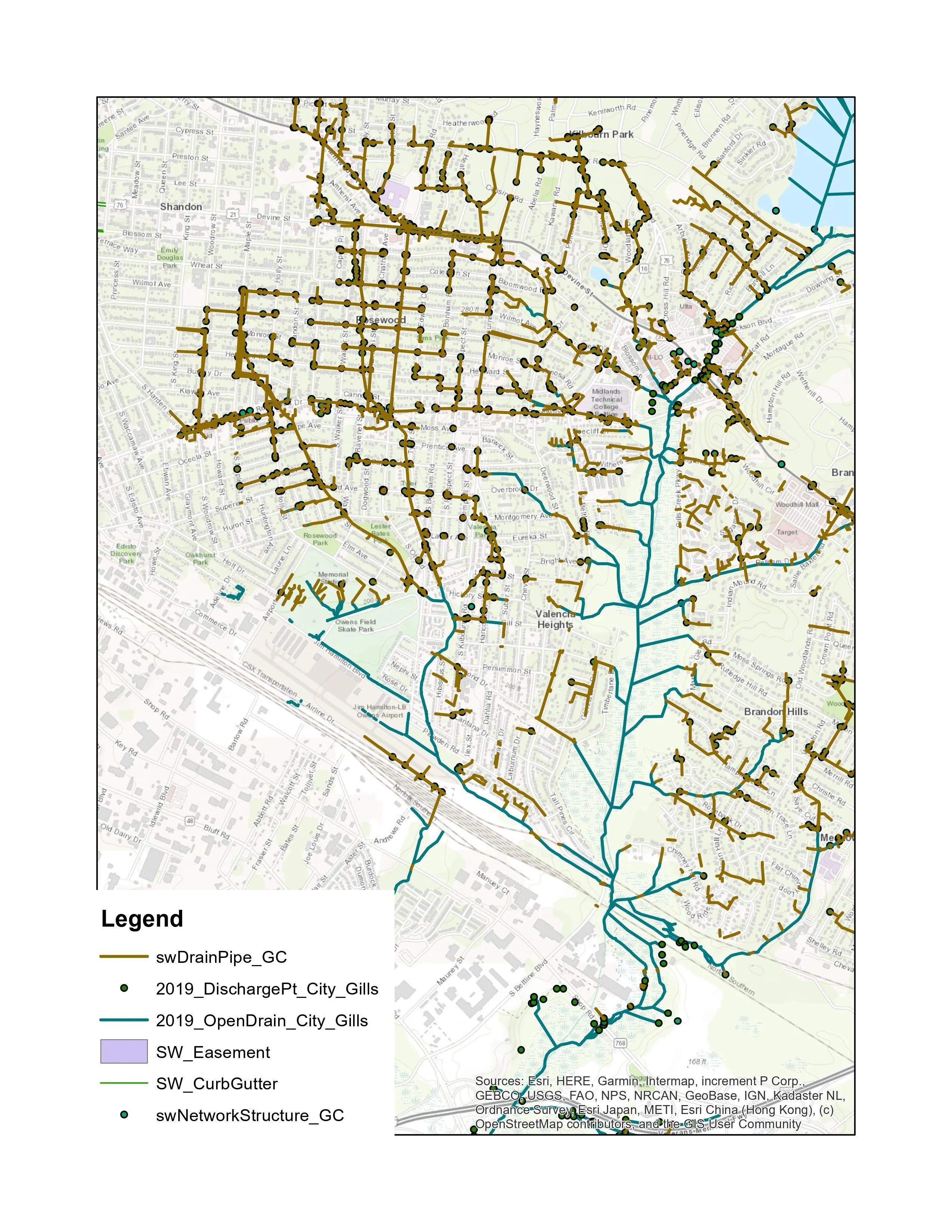
Stormwater Map
This map shows stormwater drainage for Sherwood Forest, Shandon, Heathwood, and Melrose Heights and was produced by Jason Hetrick at McCormick Taylor for the GCWA Watershed Management Plan. Click image to expand map.
